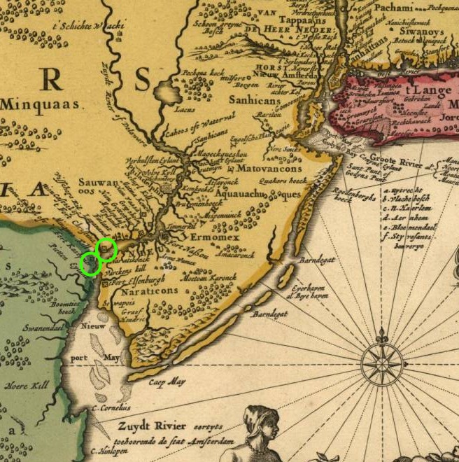
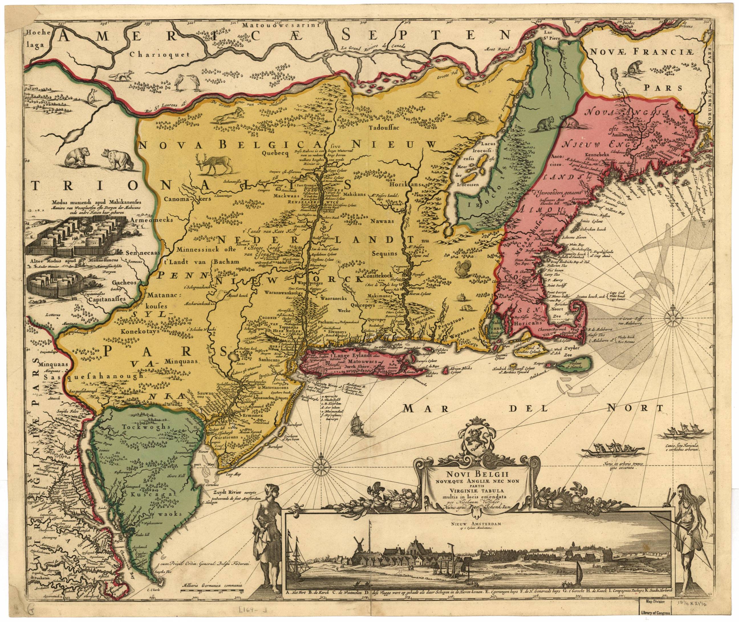
Jannson Visscher Map of New Netherlands, 1685
(click on image to enlarge, or click here for a detailed image)

When Adrian Van der Donck left New Amsterdam in 1650 to go to Amsterdam to plea for colonists rights, he had a map produced to aid aid in his arguments. These events are described in delightful detail in Russell Shorto's "The Island At The Center of The World" and brief Wikipedia entries on Van der Donck, and a virtual tour of New Netherlands and the Fordham collection of maps.
At the time the map was drawn, the Swedes had Fort Christina on the Delaware side of the Delaware River at the Minquas Kill, and Fort Elfenborg across the river in New Jersey. The copper plate used to make the original map was modified and reused over many years. This 1685 version shows Fort Kasymier (Kasimir) had been added to the Minquas Kill and Fort Christina, all circled in the detailed version.