Overlay of c1680 and 2008 parcel maps
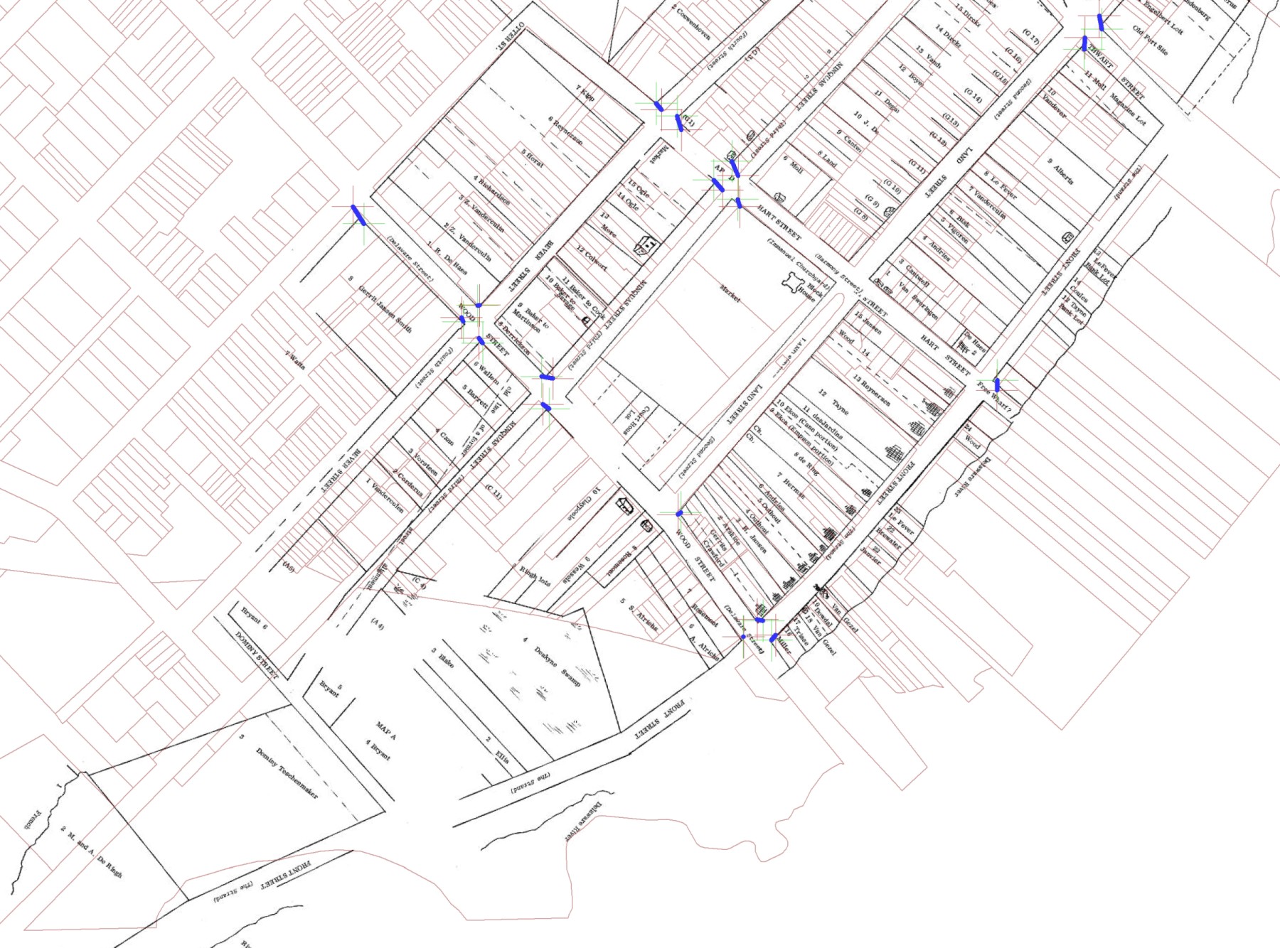
(Overlay of a composite of the Heite 1680 maps (black)
over 2008 tax parcel map) Click on map to see enlarged full map. Courtesy Louise B. Heite
 Overlays allow easy visual of similarities and differences between New Castle now, and 300 years ago.
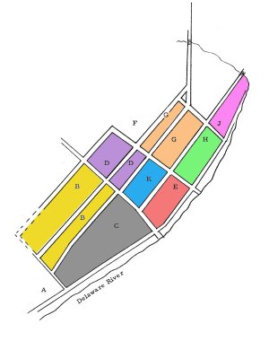
Click on areas B, C, E, H, J, K in the sketch map to see the overlays in the box above.
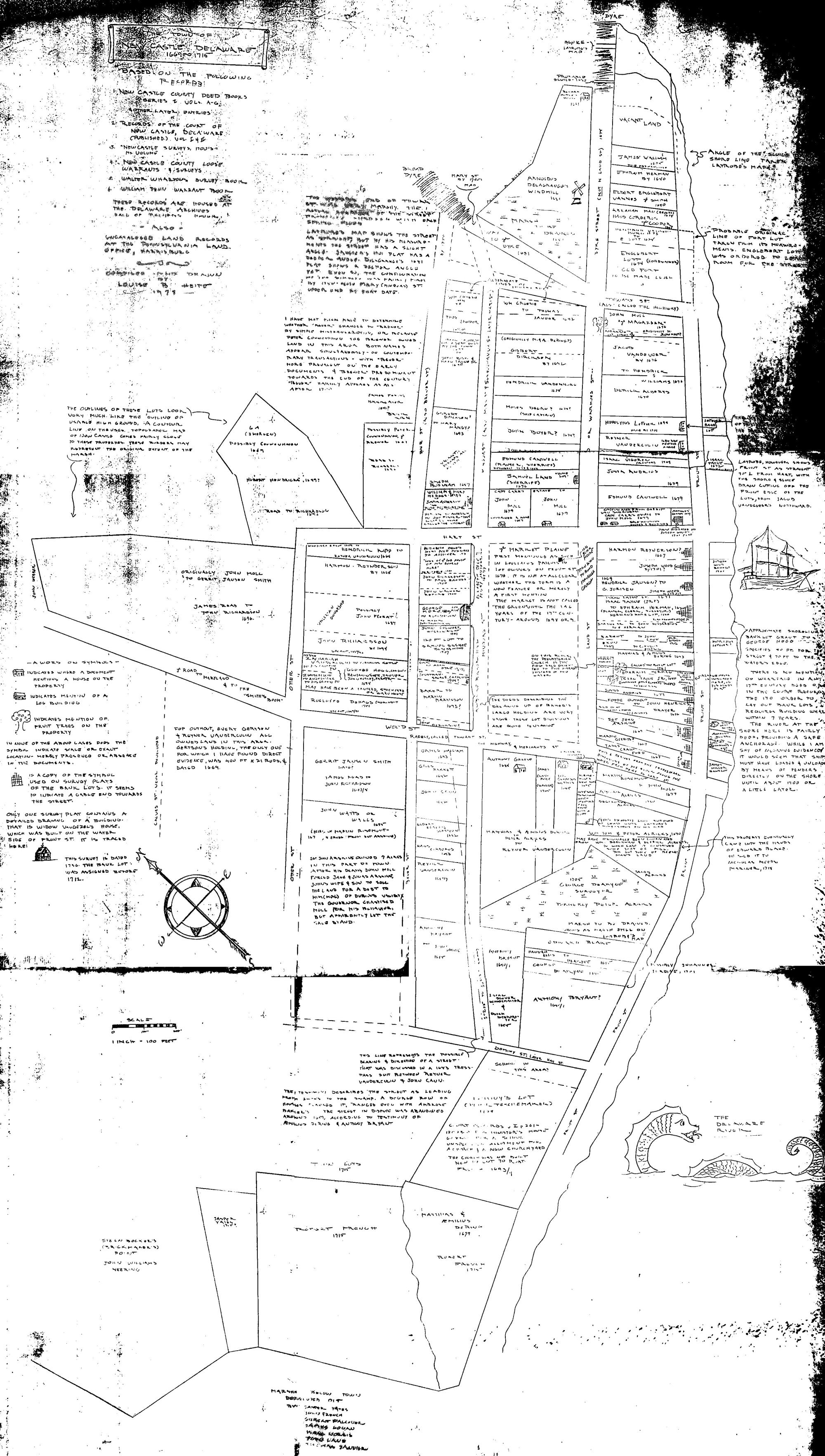
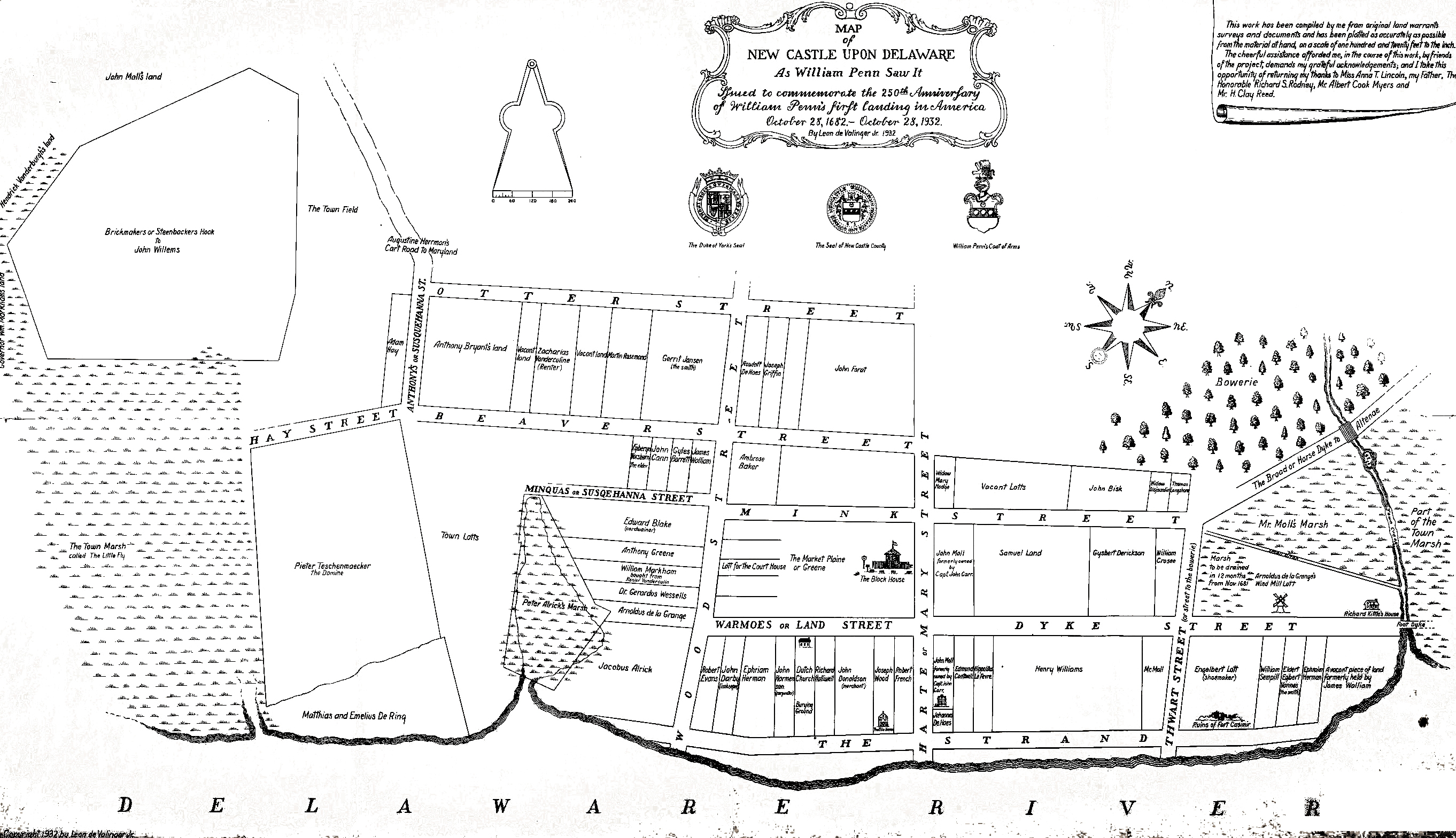
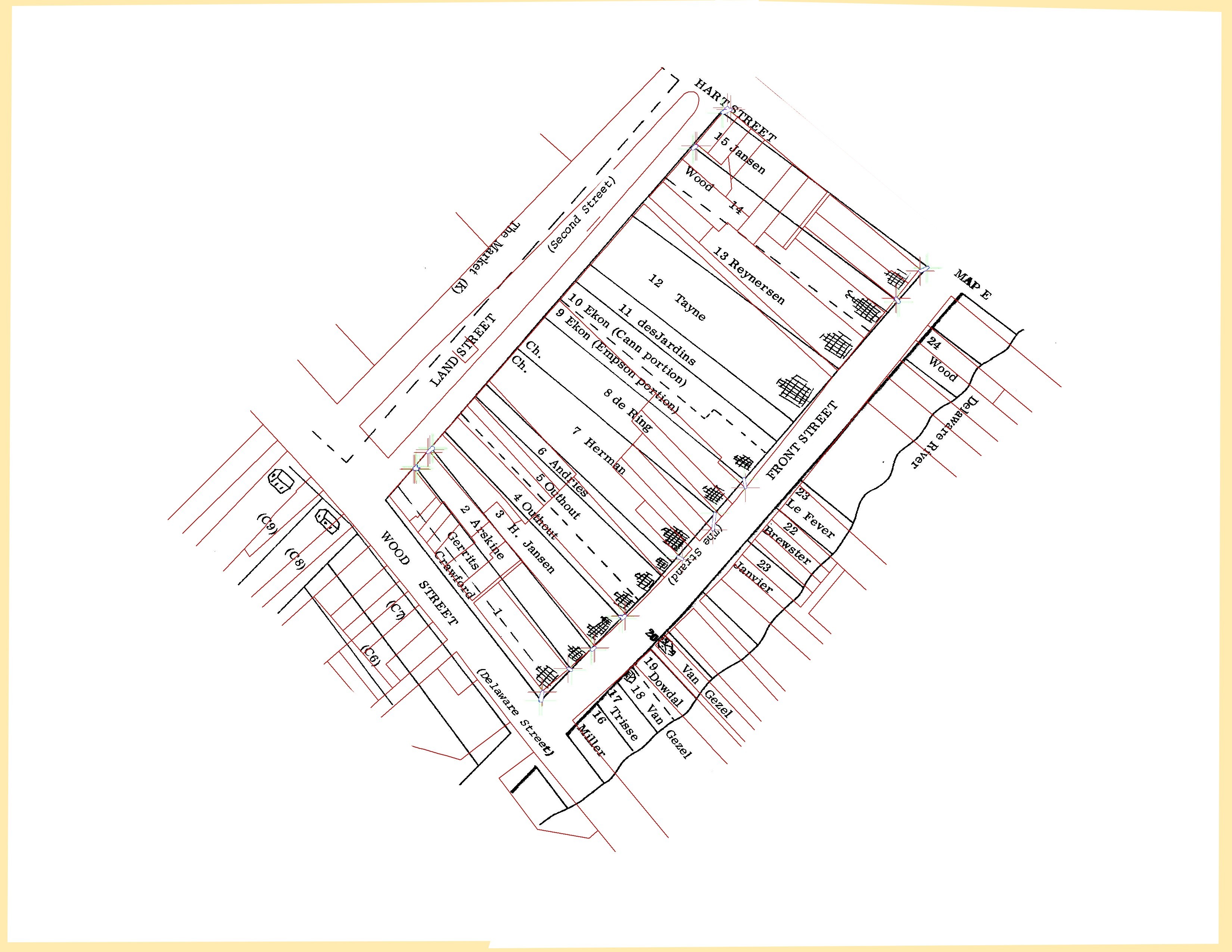
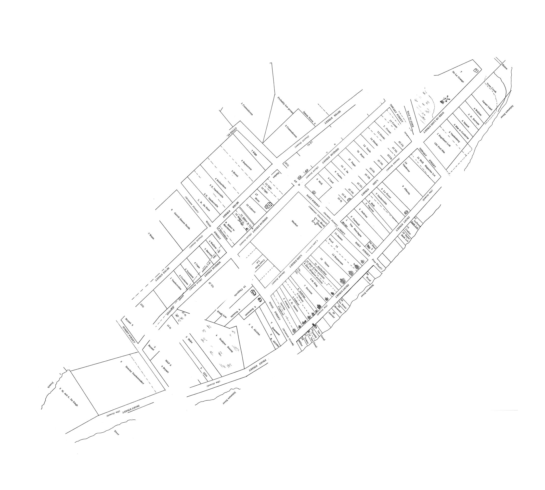
When all 9 maps from Louise Heite were assembled into a composite, and overlayed on county parcel maps it becomes apparent how little has changed for the block and street layout in the center of town.
The same is not true for population density. Most parcels have been subdivided into two or many more smaller parcels. For example in block E (between Delaware, Harmony, Strand and 2nd), the single parcel E-X running along Harmony between the Strand and 2nd has been subdivided into 8 parcels.
Individual overlays were not created for areas A, G, or F, either because there were too few control points for alignment (A, F), or it was not clear where the overlay should be placed.
This problem can be avoided with and overall view made by assembling all the individual maps since they are done at the same scale. Though less accurate for individual blocks, the combined map overlay does confirm that the overall plans in 1680 and 2008 are similar.
Overlays allow easy visual of similarities and differences between New Castle now, and 300 years ago.
Click on areas B, C, E, H, J, K in the sketch map to see the overlays in the box above.
When all 9 maps from Louise Heite were assembled into a composite, and overlayed on county parcel maps it becomes apparent how little has changed for the block and street layout in the center of town.
The same is not true for population density. Most parcels have been subdivided into two or many more smaller parcels. For example in block E (between Delaware, Harmony, Strand and 2nd), the single parcel E-X running along Harmony between the Strand and 2nd has been subdivided into 8 parcels.
Individual overlays were not created for areas A, G, or F, either because there were too few control points for alignment (A, F), or it was not clear where the overlay should be placed.
This problem can be avoided with and overall view made by assembling all the individual maps since they are done at the same scale. Though less accurate for individual blocks, the combined map overlay does confirm that the overall plans in 1680 and 2008 are similar.