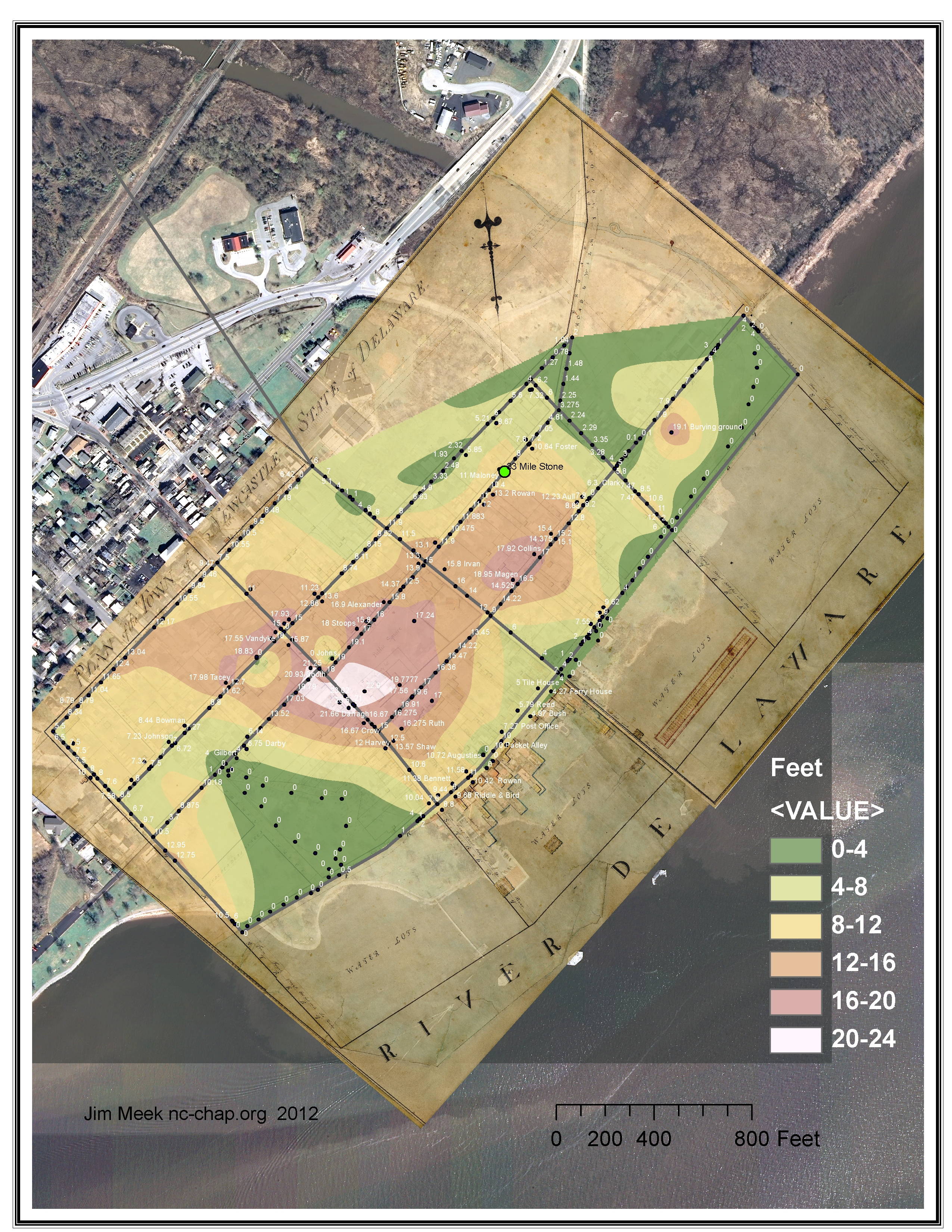
Topography of New Castle in 1805
DRAFT!
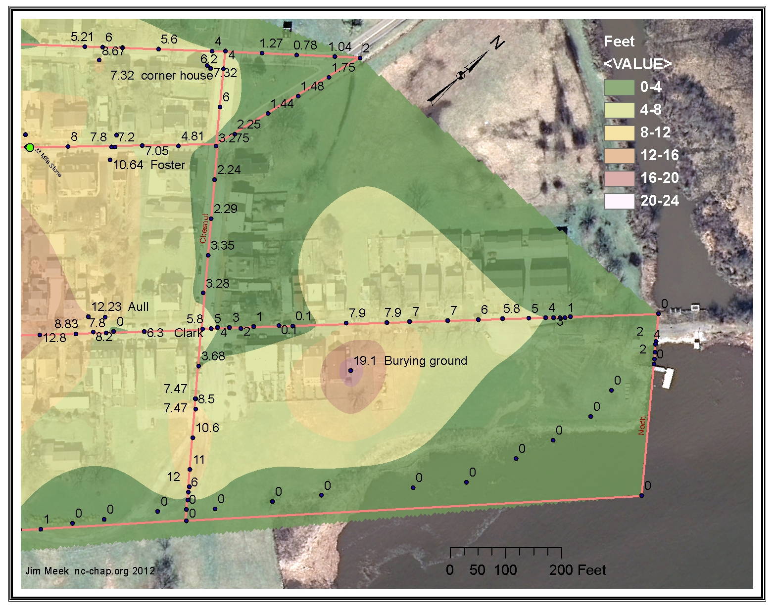
Calculated 1805 contour map of the Bull Hill area of New Castle. Fort Casimir, the landing place of the Dutch in 1651 was located in this area. The contours were calculated based on the points shown which were taken from the Latrobe 'sections', or elevations. Note that the contours are speculative, since the only point in the center of the block is that of the burying ground, and even that is known only as a distance from Chesnut street.
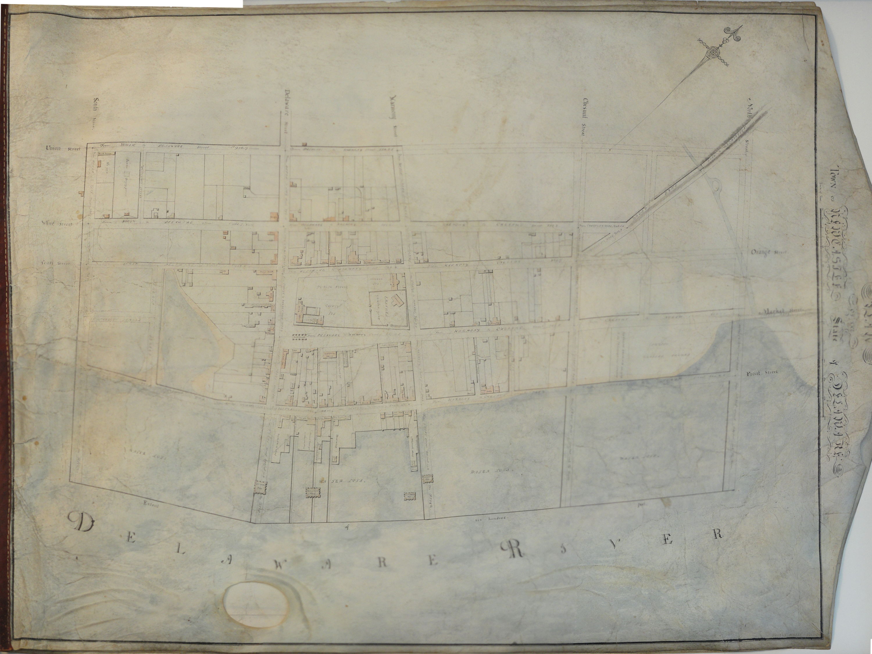
An 1804 act called for the newly elected commisioners of New Castle to "make a ground plan of the said town ascertaining the ascents and descents of the streets lanes and alleys." The elevations Latrobe recorded in the resulting survey are of particular interest to address the question of 'Where was Fort Casimir?.'
The Fort presumably lay east of Chesnut, south of 2nd/Market street and west of the town ditch (the never built North Street). Chesnut street then ended in a 12 ft high bluff next to the river.
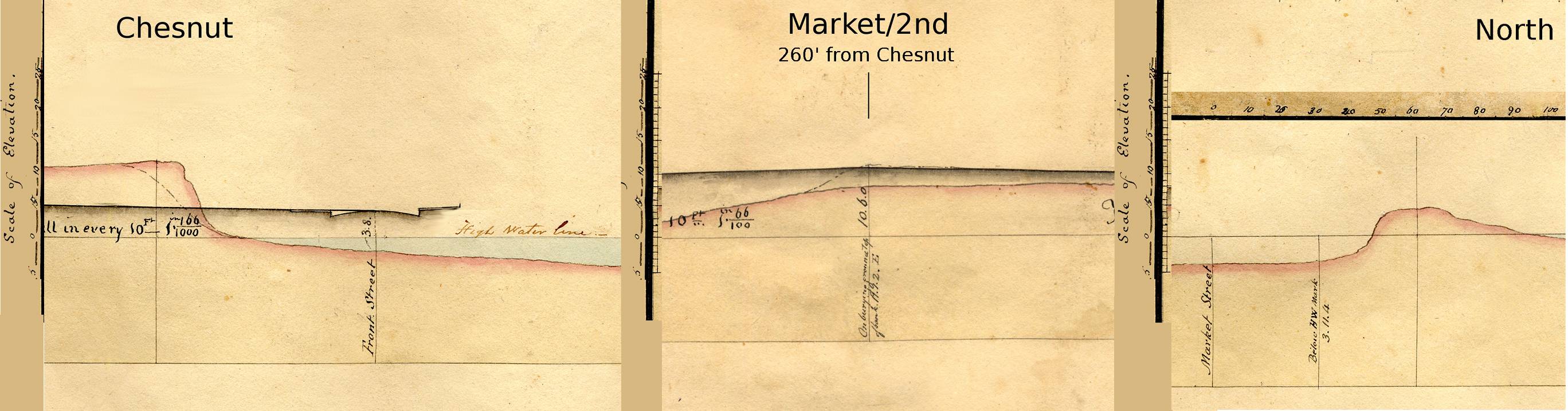
Market street near Chesnut was at the high water level, then rose slowly to 7.9 ft. Latrobe recorded at a point 260 feet from Chesnut: "on burying ground at top of bank at 19.1.2.E (19.1ft)". Market continued on to North street where it was 3.11.4 (3.95) ft below high water mark. About 50-70 ft below Market, North had a small 4 ft rise. Whether this high area continued towards the hill is not known.
I created contour maps based on points along the streets using GIS. For the Latrobe survey, the elevation points used were those on the map, or read from the map in GIMP, a free image manipulation program with adjustable vertical and horizontal reference lines for comparison against the map scales.
For comparison with 2012 data, I obtained a similar array of points where streets crossed the 2 ft contour lines of LIDAR data.
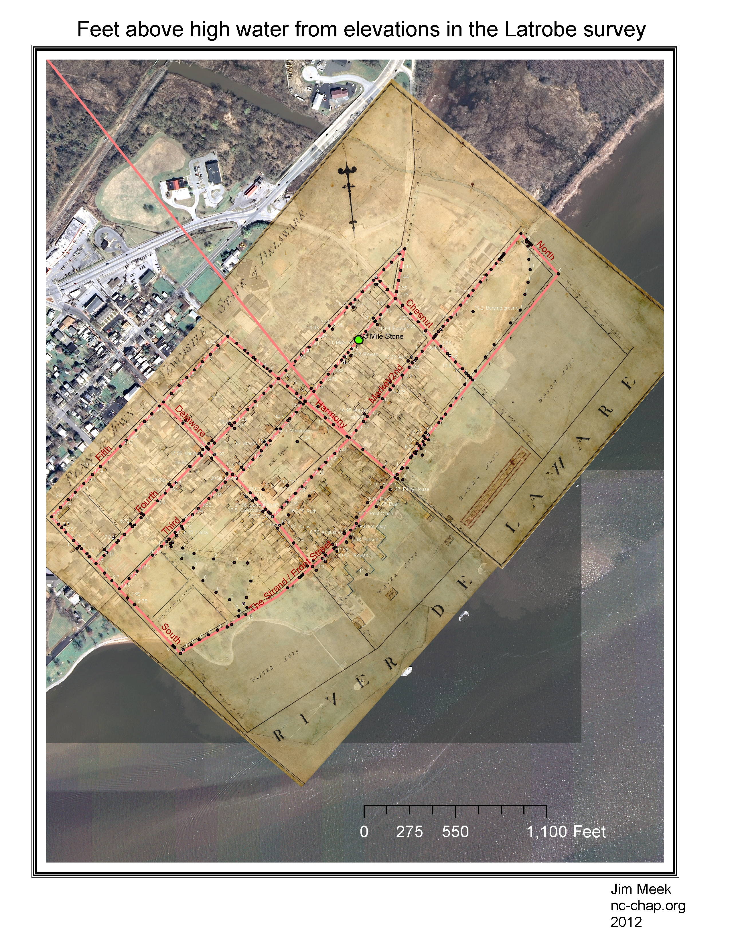 1805 data: points with feet above high water level taken from Latrobe survey elevations, and superimposed on the survey plan. Owner or tenant indicated in many cases. Click on image to enlarge. | 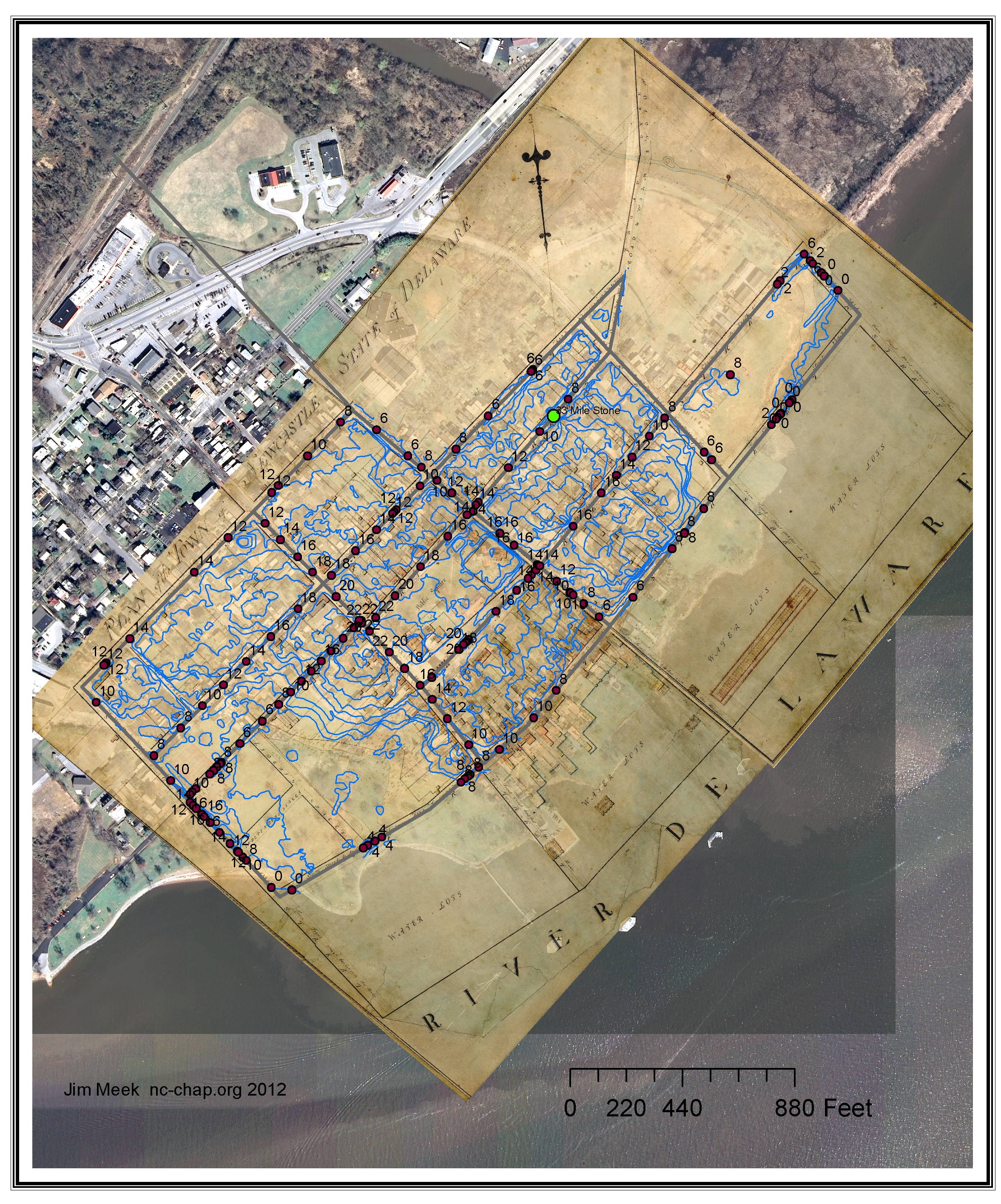 2012 data: two foot LIDAR contours are plotted where they are within the area enclosed by streets in the Latrobe survey. Points indicated where the streets cross a contour, and the height above mean sea level at that point. |
To create the contour plots, I used the ArcMap "natural neighbor" method.
 | 
|
The most obvious differences are the shaving off of Bull Hill and the bluff at the end of Chesnut, filling in the land north of 2nd in Bull Hill, and filling in the current parkland in Battery Park, The Strand between Harmony and Chesnut, and low lying areas near E.4th and Harmony. Not shown is the extensive fill that occurred at the watefront. | |
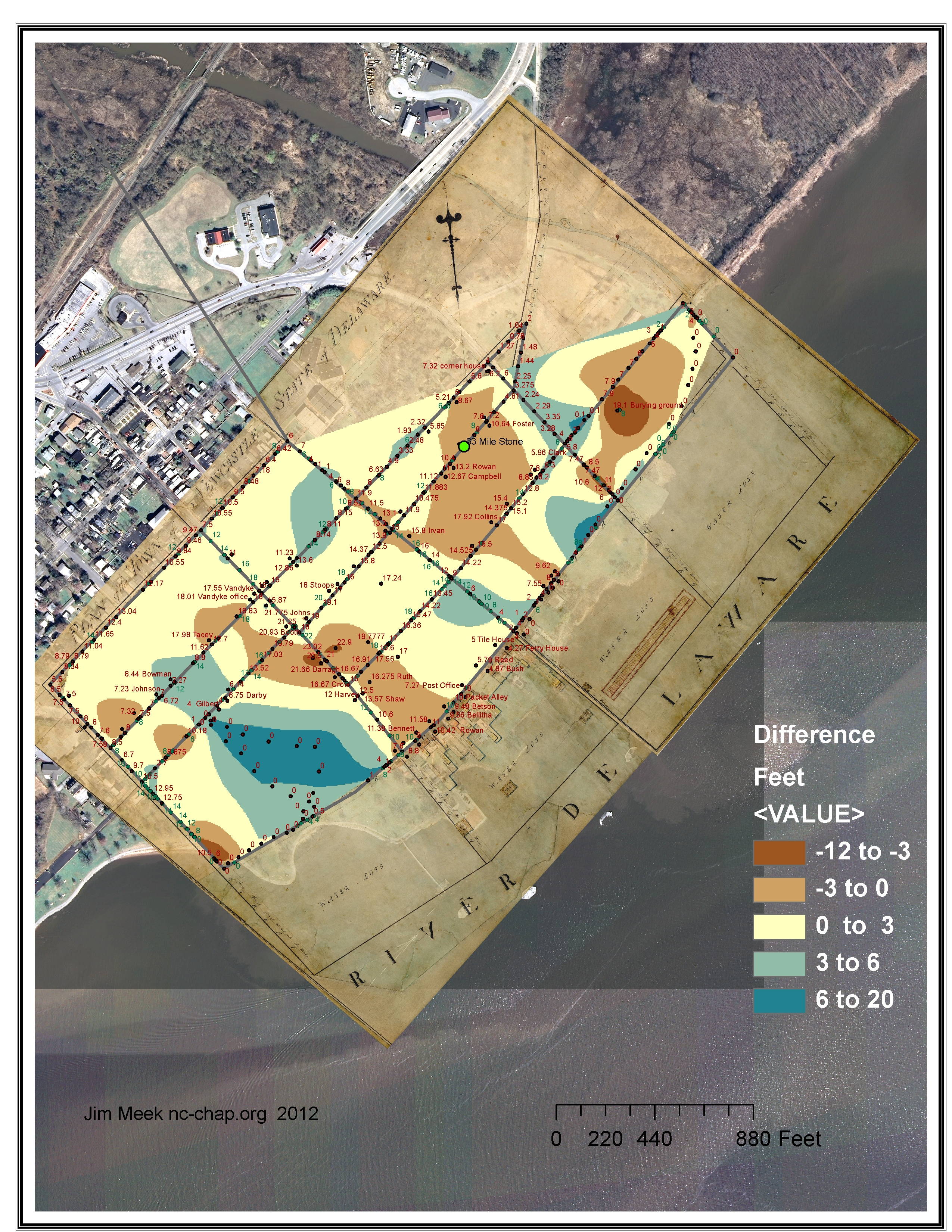
| Differences between the 1805 and 2012 contour maps. Color coding = brown: earth removed; blue = earth added. Defects in the data limit the accuracy or usefulness of the plot: Latrobe data was taken every 20 - 40 feet and referred to the high water line. The 2012 data is only where 2 foot contour lines cross the streets. In places such as along The Strand between Harmony and Chesnut there are no points because the street passes below the houses on the bluff. Another method is needed for comparison. |
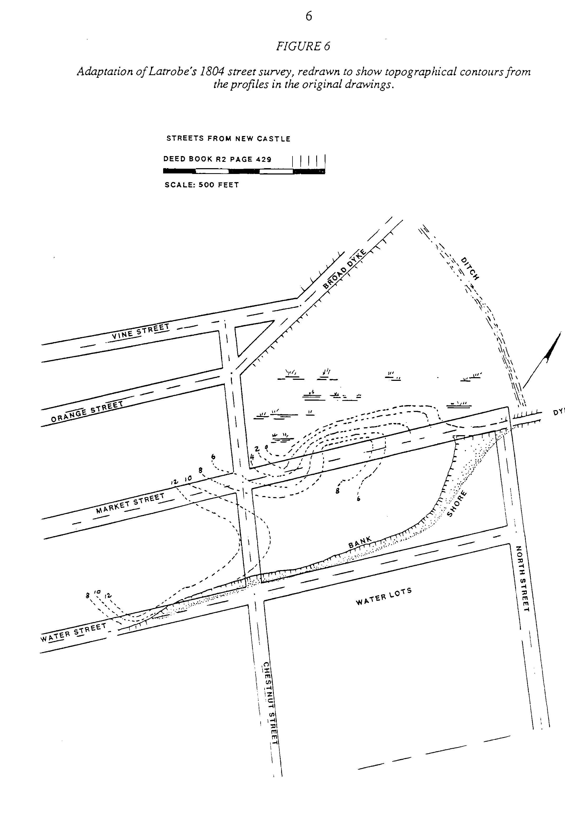
In Fig 6 of the Heite report are speculative elevation contours for this area based on the Latrobe survey. They also show high ground at the end of Chesnut street, low ground to the east of the intersection with Market, and higher ground south and east of that point. However, perhaps the copy of the survey they used did not have the notation about the burying ground, they did not include the prominent elevation there.
There are two early aerial photos of the area (one mislabeled as N.J) from Hagley Museum & Library: 1929 and 1937. Both show what can be imagined as a hill just beyond the last house on the water side of 2nd, and both showing that the ground became marsh shortly after the lot lines of the houses.
The draft copy of the survey owned by the New Castle Historical society (not yet scanned at high resolution) shows this block divided into three lots. The lot lines are not in the final copy at the Delaware Public Archives. One, labeled "Public Burying Ground" starts between the current playground and the last house. A second, labeled "Presbyerian Church Burying Ground" occupies the last 4 of the current lots. The remaining lot occupies the current parking lot and adjacent seven lots. Records of the Presbyterian Church do not show burials other than adjacent to the church or the "rural cemetery" west of town which was established around 1804.